
SkiVis: Visual Exploration and Route Planning in Ski Resorts
Lastest Update: 23rd April 2024
Introduction
What: A visual analytics application to interactively explore ski slopes and provide routing recommendations based on user preferences.
Related Work
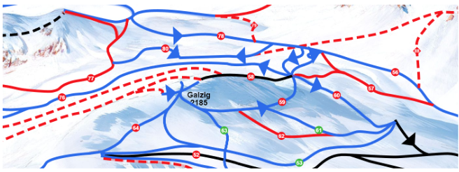
- Ski Visualizations
- The painted panorama style distorts the underlying topography to emphasize certain memorable features
- Metro map
- Preference-based visualization techniques reduce time required for route planning
- Visualizing slopes by a color-coded line according to their difficulty
- Display further information on individual slopes
- The painted panorama style distorts the underlying topography to emphasize certain memorable features
- Routing in Geospatial Networks
Motivation
Research Gap: No analysis approach exists that enables the visual exploration of the resort and interactively provides routing recommendations based on user-defined preferences.
- The painted panorama style distorts the underlying topography to emphasize certain memorable features
- Display further information on individual slopes
- Most approaches for route planning focus on other outdoor activities such as cycling or hiking
- Neglect user-specific preferences
Requirement and design
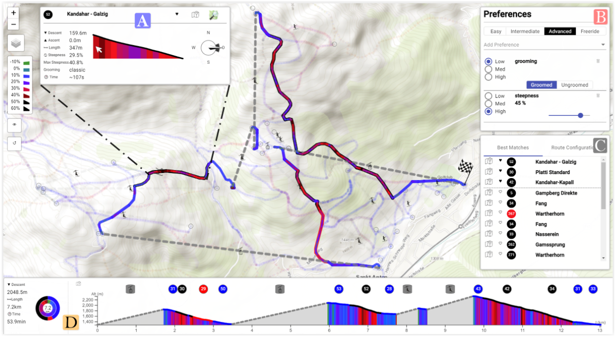
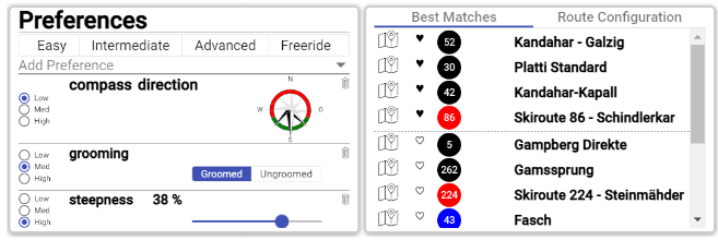
- [T1]Exploration of a ski resort according to the defined features
- Double-line visual approach consisting of an outer and inner line
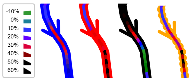
- Tooltip
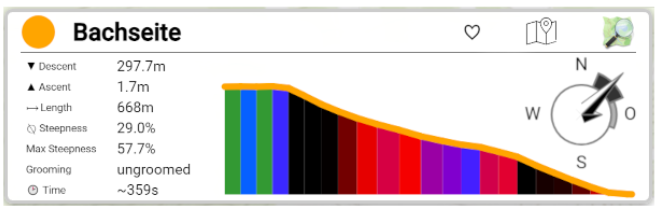
- Double-line visual approach consisting of an outer and inner line
- [T2]Provide a ranking based on preferences toward these features
- [T3]Allow routing between two arbitrary network points Neglect user-specific preferences
- Dijkstra
- [T4]Integrate preferences into the routing algorithm
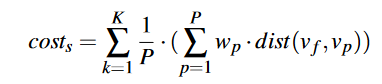
- Compute cost for each slope according to the user preferences
- Automated/semi-automated workflow
- Compute cost for each slope according to the user preferences
Critical thinking
- New area ?
- Color encoding
- Satisfy the collective preference